I love maps, aviation, and photography, so planning for a drone flight combines a lot of my favorite things. Drones are obviously fantastic for aerial landscape photography, but I also like to play with aerial portraiture. I'm surprised there aren't a lot more people doing it. I've taken some bird’s-eye pictures with my DJI mini 3 pro with great results.
Planning a flight is critical for safety, because the last thing we want to do is harm people, property, or worse, flying aircraft.
Maps of how Federal airspace is designated are critical for planning, so let's go over how we can use one of these maps to find good places to fly, and which places are off limits.
Remember, there's no substitute for your own due diligence. When you prepare to fly you'll need to check official and up-to-date airspace sectionals, weather reports and local ordinances.
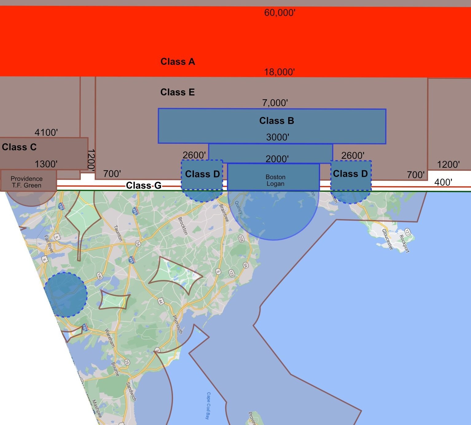
Simplifying the Sectional
Here is the sectional map over Massachusetts. It's designed to show pilots how all of the airspace in a given area is allocated. With a drone we're only concerned with the airspace nearest the ground. Specifically the up to 400 ft above ground level, which is the upper limit for a part 107 qualified drone pilot.